Property Details
Property Description
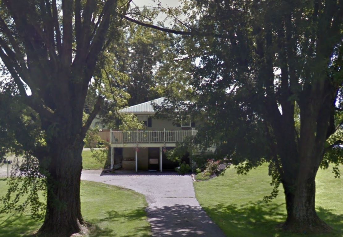
Subject property is a 3 BR / 2.00 BA Single family home w/ 0 Car Garage containing 2,580 Sq Ft +/- built in 1958. Parcel number: 190413122000,190413123000. Minimum Bid $ 36,666.67 . All auction end Wednesdays at 1PM. 5% buyer's premium will apply over and above high bid. Please read terms and conditions for details related to purchasing foreclosure property. Interior showings are not available. To earn a commission, Buyer referrals must be made to Auctioneer before prospective buyers make any contact with Auctioneer or register for bidding. Use link: https://www.gryphonusa.com/broker-acknowledgement-form/ This is a foreclosure situation. Property being offered by Private Selling Officer per the authorities granted in Ohio Revised Code 2329.152 . Information available has come from public sources and is believed to be accurate but is not guaranteed. Buyers should conduct their own due diligence before bidding. List Agent has not physically viewed the property. Due to the nature of the sale, interior inspections are not allowed. Cash sale only. No financing.
Legal Description
Situated in the Township of Liberty, County of Ross, State of Ohio, and being bound and described as follows: Parcel Number 19-0413122.000 First Tract: Being a part of the SE quarter of Section 9, Township 8N, Range 20W and beginning at a spike in the center of U.S. Route 50 and in the west line of the SE quarter Section 9, Twp. 8N, Range 20W, said spike being the NW corner of the tract of which this is a part and the NE corner of a tract of land now owned by B.G. Jones; Thence, with the center line of U.S. Route 50, S. 58 deg. 03' E., 150 feet to a spike in the center of U.S. Route 50; Thence, with a line through the tract of which this is a part, and passing an iron pin at 32.36 feet, S. 09 deg. 56' W., 290 feet to an iron pin; Thence, with another line through the tract of which this is a part, N. 58 deg. 03' W., 150 feet to an iron pin in the west line of the SE quarter of Section nine (9) Township 8N, Range 20W and in the east line of B.G. Jones; Thence, with said quarter section line and the line of Jones and passing an iron pin at 257.64 feet, N. 09 deg. 56' E., 290 feet to the place of beginning, containing 0.926 acres, more or less, subject to all legal highways. And being a part of 69.53 acres surveyed for Emmett E. Freeman and Margaret E. Freeman by C.S. Waldren, Registered Surveyor, July 27, 1951, subject to all legal highways. Save and Excepting Therefrom 0.463 Acre Conveyed to Charles H. and Georgeanna Smith by deed dated 9/5/58 and recorded in DR 304-540. RCDR Leaving and Remaining to be conveyed herein 0.463 acres. Parcel Number: 19-0413123.000 Second Tract: Being a part of the SE quarter of Section 9, T8N, R20W and beginning at a spike in the centerline of U.S. Route 50, said spike being the NW corner of the tract of which this is a part; Thence, with the centerline of U.S. Route 50, S. 58 deg. 03? E., 100 feet to a spike; Thence, with a line through the tract of which this is a part and passing an iron pin at 30.09 feet, S. 27 deg. 32' W., 269.35 feet to an iron pin in the south line of said tract; Thence, with said S. line, N. 59 deg. 49'W., 12.0 feet to an iron pin; Thence, with the W. line of the tract of which this is a part and passing an iron pin at 257.64 feet, N. 09 deg. 56' E., 290.00 feet to the place of beginning, containing 0.346 acre and subject to all legal highways. And being a part of the same tract conveyed by Emmett E. and Margaret E. Freeman to Oris A. and Nettie B. Duffy by deed dated June 23, 1951, and recorded in Volume 262, Page 456, Ross County Deed Records.
Location
Foreclosure Details
Click the link to review the Conditions of Sale for this auction.
Conditions of SaleAuction By
