Property Details
Property Description
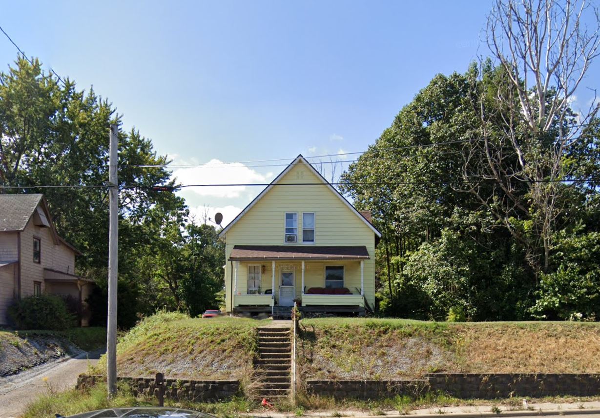
Subject property is a 3 BR / 1.50 BA Single family home w/ 0 Car Garage containing 1,272 Sq Ft +/- built in 1995. Parcel number: 2014507. Minimum Bid $ 66,000.00 . All auction end Wednesdays at 1PM. 5% buyer's premium will apply over and above high bid. Please read terms and conditions for details related to purchasing foreclosure property. Interior showings are not available. To earn a commission, Buyer referrals must be made to Auctioneer before prospective buyers make any contact with Auctioneer or register for bidding. Use link: https://www.gryphonusa.com/broker-acknowledgement-form/ This is a foreclosure situation. Property being offered by Private Selling Officer per the authorities granted in Ohio Revised Code 2329.152 . Information available has come from public sources and is believed to be accurate but is not guaranteed. Buyers should conduct their own due diligence before bidding. List Agent has not physically viewed the property. Due to the nature of the sale, interior inspections are not allowed. Cash sale only. No financing.
Legal Description
Situated in the Township of Lake, County of Stark and State of Ohio: Known as and being Part of the Southeast Quarter of Section 31, Township 12 (Lake Township) Range 8, Stark County, Ohio, and being more particularly described as follows: Beginning for the same at a point marked by a 7/8 inch iron bar found at the intersection of the centerline of Mt. Pleasant Street N.W. (CR-7) with the centerline of the West right-of-way line of Cleveland Avenue (CR-66); Thence S 00 degree 30' 43" W along a portion of the centerline of the West right-of-way line of said Cleveland Avenue a distance of 399.71 feet to a point marked by a mag nail set at the southeast corner of a (1.00 acre) tract of land now or formerly owned by Milton & Gracie Baltzly, and being the true place of beginning for the tract of land herein described; Thence continuing S 00 degree 30' 43" W along a portion of the centerline of said West right-of-way line a distance of 9.05 feet to a point marked by a mag nail set at the northeast corner of a 0.035 acre tract of land now of formerly owned by The Board of Stark County Commissioners, as recorded in Stark County Recorders Instrument No. 97015008; Thence S 89 degrees 42' 33" W along the north line of said 0.035 acre tract of land a distance of 34.27 feet to a point marked by a 1/2 inch iron bar set; Thence S 11 degrees 01' 09" W along a portion of the West line of said 0.035 acre tract (the West right-of-way line of said Cleveland Avenue) a distance of 30.59 feet to a point marked by a 1/2 inch iron bar set; Thence S 00 degrees 17' 27" E continuing along a portion of the West Line of said 0.035 acre tract of land and said right-of-way line, a distance of 9.80 feet to a point marked by a 1/2 inch iron bar set on the north line of a (0.66 acre) tract of land now or formerly owned by Gregory S. Croston, as recorded in Official Record Volume 307, Page 454 in the Stark County Records of Deeds; Thence N 88 degrees 19' 15" W along a portion of the North line of said (0.66 acre) tract of land, a distance of 401.95 feet to a point marked by a 1/2 inch iron bar set on the east line of Lot 1 in Highmeadow Subdivision, as recorded in Plat Book 39, Page 3 in the Stark County Records of Plats; Thence N 01 degree 33' 41" E along a portion of the east line of said Lot 1, a distance of 50.16 feet to a point marked by a 1/2 inch iron bar set at the southwest corner of previously stated (1.00 acre) Milton & Gracie Baltzly tract of land; Thence S 88 degrees 19' 39" E along the south line of said (1.00 acre) Milton & Grade Maltzly tract of land, (passing over a 1/2 inch iron bar set at 407.74 feet) a total distance of 440.75 feet to a point marked by a mag nail set on the centerline of the west right-of-way line of Cleveland Avenue (C-66) and being the true place of beginning and containing 0.473 acre of land more or less of which 0.007 acre lies within roadway right-of-way. Subject to any and all easements, reservations, or restrictions that may be of record pertaining to the above described tract of land. Note: Reference direction for bearing system used in above description, was established from the centerline Survey Plat of Cleveland Avenue (C.R. 66) as recorded in Plat Book 61, Pages 127-130, using S 00?17'27" for the construction of the centerline (Hoover Line) of Cleveland Avenue. As surveyed on the 13th day of August, 1998 by Jerold E. Geib, Registered Surveyor No. 6725.
Location
Foreclosure Details
Click the link to review the Conditions of Sale for this auction.
Conditions of SaleAuction By
