Property Details
Property Description
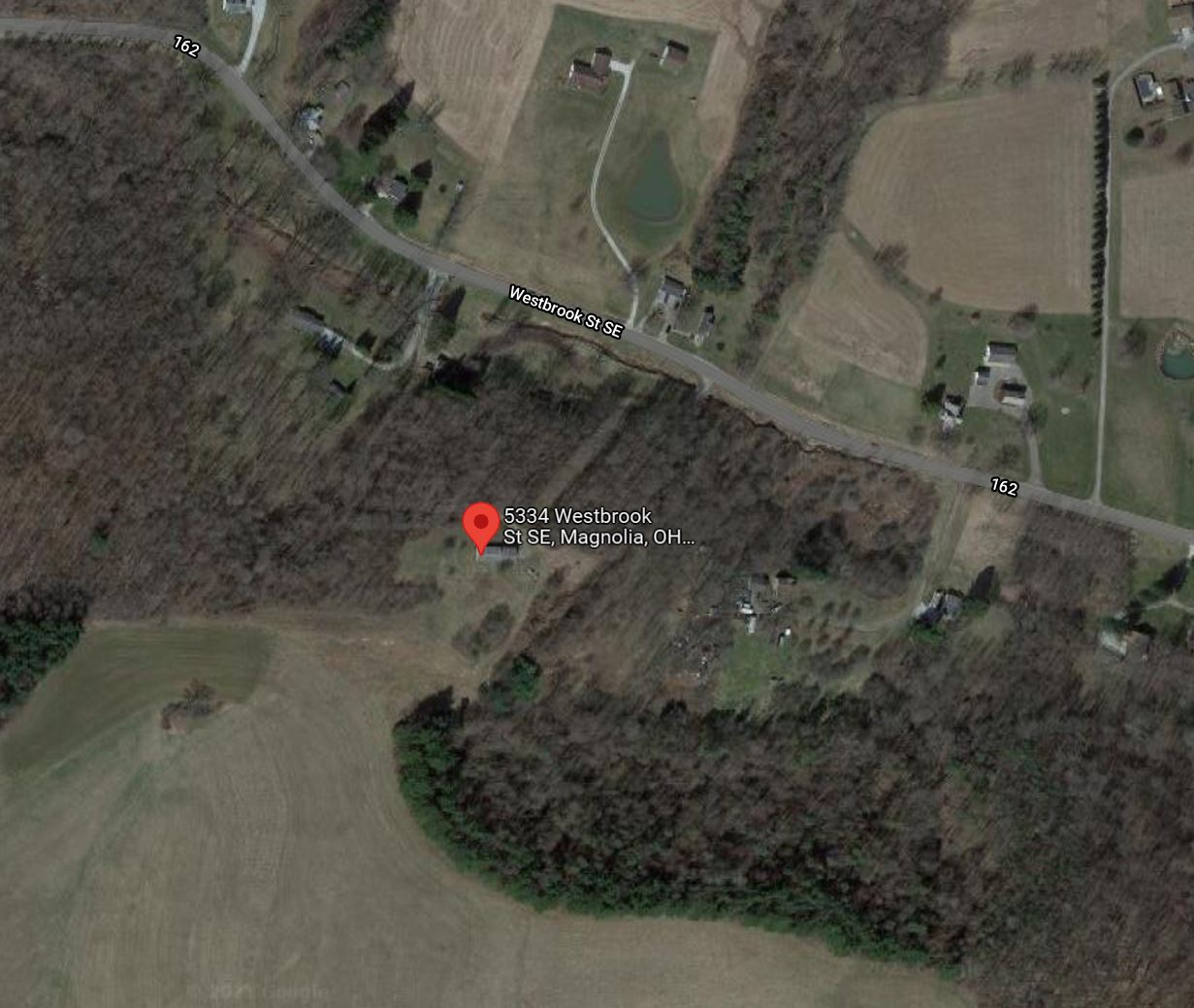
Subject property is a 3 BR / 1.00 BA w/ 3 Car Garage, containing 1,242 Sq Ft +/- built in 1962. Parcel number: 6100112. Minimum Bid $ 1,000.00 . All auction end Wednesdays at 1PM. 5% buyer's premium will apply over and above high bid. Please read terms and conditions for details related to purchasing foreclosure property. Interior showings are not available. To earn a commission, Buyer referrals must be made to Auctioneer before prospective buyers make any contact with Auctioneer or register for bidding. Use link: https://www.gryphonusa.com/broker-acknowledgement-form/ This is a foreclosure situation. Property being offered by Private Selling Officer per the authorities granted in Ohio Revised Code 2329.152 . Information available has come from public sources and is believed to be accurate but is not guaranteed. Buyers should conduct their own due diligence before bidding. List Agent has not physically viewed the property. Due to the nature of the sale, interior inspections are not allowed. Cash sale only. No financing.
Legal Description
Situated in the Township of Sandy, County of Stark and State of Ohio and known as and being a part of the northwest quarter of Section #30, Township #17, Range #7, Sandy Township, Stark County, Ohio. Beginning at an iron pin at the northwest corner of section #30, thence south 44 degrees 14' east in county road #162, 242.90' to an iron pin; thence south 50 degrees 16' west 17.80' to an iron pin in the center of said road; thence south 35 degrees 44' east along the center of said road 255.42' to an iron pin; thence south 65 degrees 14' east along the center of said road 200.00' to an iron pin; thence south 16 degrees 47' 30" west 261.34' to an iron pin; thence south 39 degrees 31' 20" west 275.08' to the PC of a curve; thence along said curve to the left of said curve having a radius of 51.93', a central angle of 123 degrees 57' 20" a distance of 112.35' to the pt of said curve; thence south 84 degrees 27' east 180.00' to an iron pin and the true place of beginning for the tract herein described; thence continuing south 84 degrees 27' east 160.00' to an iron pin; thence south 6 degrees 33' west 125.00' to an iron pin; thence north 84 degrees 27' west 160.00' to an iron pin; thence north 6 degrees 33' east 125.00' to an iron pin and the true place of beginning, containing 0.459 of an acre more or less. Further granting the grantee herein the right of egress and ingress over the following described premises: Situated in the Township of Sandy, County of Stark and State of Ohio: known as and being a part of the northwest quarter of section #30, township #17, range #7, Sandy Township, Stark County, Ohio. Beginning at an iron pin at the northwest corner of said section #30, thence south 44 degrees 14' east in county road #162 242.90' to an iron pin; thence south 50 degrees 16' west 17.80' to an iron pin in the center of said road; thence south 35 degrees 44' east along the center of said road 255.42' to an iron pin; thence south 65 degrees 14' east along the center of said road 200.00' to an iron pin and the true place of beginning for the roadway herein described; thence south 16 degrees 47' 30" west 261.34' to an iron pin; thence south 39 degrees 31' 20" west 275.08' to the PC of a curve; thence along the arc of a curve to the left, said curve having a radius of 51.93', a central angle of 123 degrees 57' 20", 112.35' to an iron pin at the pt of said curve; thence south 84 degrees 27' east 340.00' to an iron pin; thence north 5 degrees 33' east 20.00' to an iron pin; thence north 84 degrees 27' west 340.00' to an iron pin at the PC of a curve; thence along the arc of a curve to the right, said curve having a radius of 31.93' and a central angle of 123 degrees 57' 20", a distance of 75.12' to an iron pin at the pt of said curve, thence north 39 degrees 31' 20" east 285.30' to an iron pin; thence north 16 degrees 46' 45" east 260.89' to an iron pin in the center of county road #162; thence north 65 degrees 14' west along the center of said road 20.35' to an iron pin and the true place of beginning.
Location
Foreclosure Details
Click the link to review the Conditions of Sale for this auction.
Conditions of SaleAuction By
