Property Details
Property Description
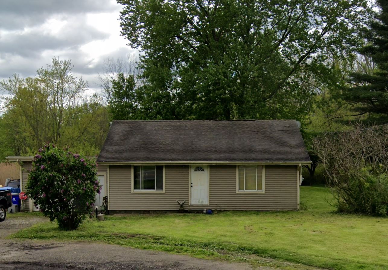
Subject property is a 3 BR / 2.00 BA Single Family Home w/ 1 Car Garage, containing 1,768 Sq Ft +/- built in 1954. Parcel number: 33-095-00-00-016-000. Minimum Bid $ 76,666.67 . All auction end Wednesdays at 1PM. 5% buyer's premium will apply over and above high bid. Please read terms and conditions for details related to purchasing foreclosure property. Interior showings are not available. To earn a commission, Buyer referrals must be made to Auctioneer before prospective buyers make any contact with Auctioneer or register for bidding. Use link: https://www.gryphonusa.com/broker-acknowledgement-form/ This is a foreclosure situation. Property being offered by Private Selling Officer per the authorities granted in Ohio Revised Code 2329.152 . Information available has come from public sources and is believed to be accurate but is not guaranteed. Buyers should conduct their own due diligence before bidding. List Agent has not physically viewed the property. Due to the nature of the sale, interior inspections are not allowed. Cash sale only. No financing.
Legal Description
Situated in the Township of Shalersviile, County of Portage and State of Ohio: And known as being part of Lot No. 95 Township, County, and State aforesaid and more particularly described as follows: Beginning at an iron pin at the intersection of the centerline of Old State Route No. 303 and the West line of said Lot No. 95; thence South 81 deg. 27' East along the centerline of Old State Route No. 303 for a distance of 1 70.00 feet to an iron pin which marks the true place of beginning of the following described parcel of land; thence continuing along the centerline of Old State Route No. 303 South 81 deg. 27' East for a distance of 200.00 feet to an iron pin in the centerline of Old State Route No. 303; thence due South along the West line of 3.678 acre of land now or formerly owned by I.R. Martin for a distance of 556.02 feet to an iron pin in the low water mark along the North side of the Cuyahoga River; thence along the low water mark along the North side of the Cuyahoga River South 51 deg. 01' West for a distance of 262.90 feet to an iron pin; thence due North (parallel with the west line of said lot No. 95 and 168.11 feet Eastwardly therefrom measured at right angles) for a distance of 759.00 feet to the true place of beginning and found to contain 2.985 acres of land as surveyed by Lucius F. Converse, Reg. Sur. 1199 in January, 1968. NOTE: The true place of beginning of the above described parcel of land is situated South 81 deg. 27' East a distance of 215.73 feet from an iron pin at an angle in said Old State Route No. 303.
Location
Foreclosure Details
Click the link to review the Conditions of Sale for this auction.
Conditions of SaleAuction By
