Property Details
Property Description
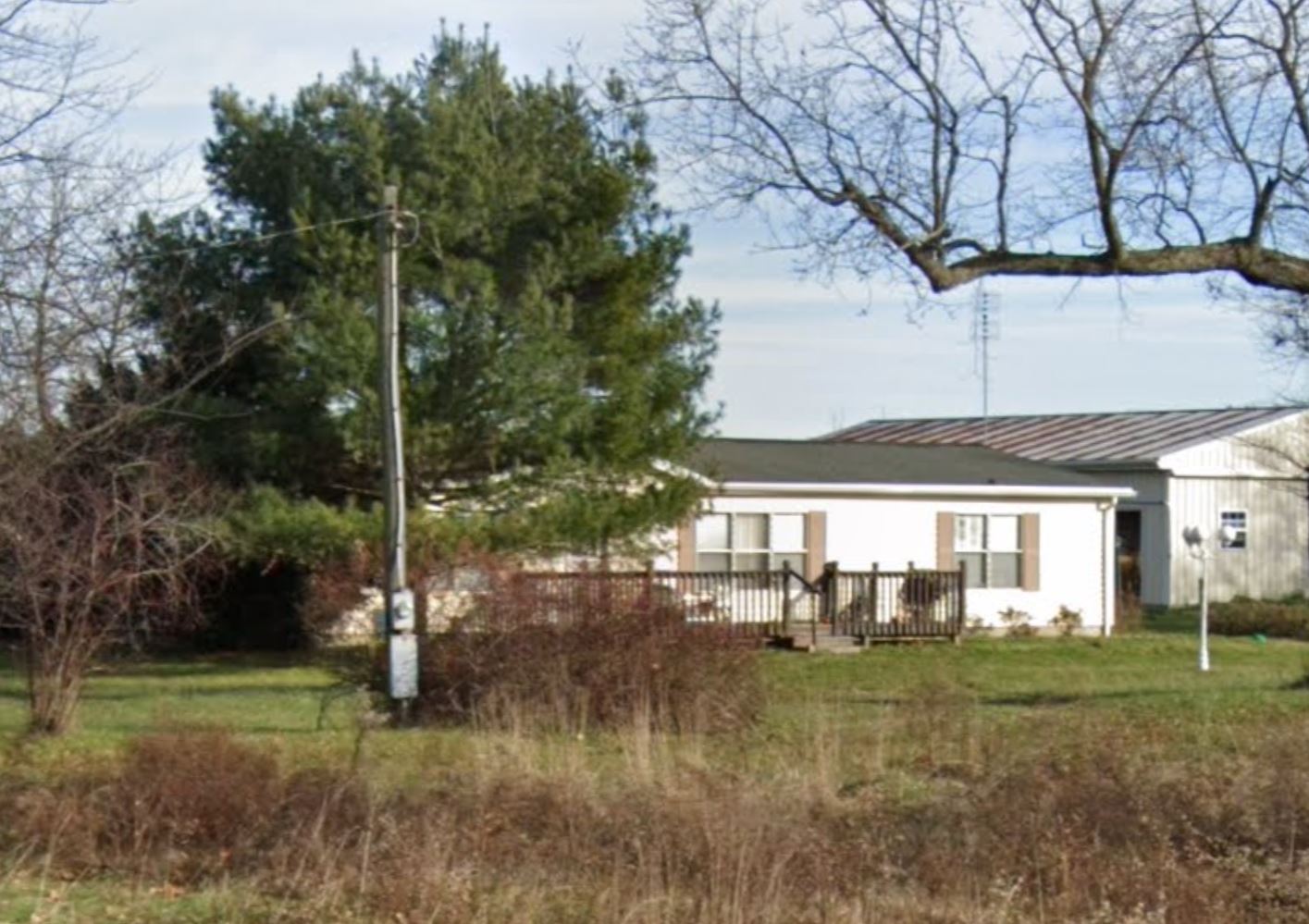
Subject property is a 4 BR / 2.00 BA Single Family Home w/ No Garage, containing 1,920 Sq Ft +/- built in 1989. Parcel number: . Minimum Bid $ 73,333.33 . All auction end Wednesdays at 1PM. 5% buyer's premium will apply over and above high bid. Please read terms and conditions for details related to purchasing foreclosure property. Interior showings are not available. To earn a commission, Buyer referrals must be made to Auctioneer before prospective buyers make any contact with Auctioneer or register for bidding. Use link: https://www.gryphonusa.com/broker-acknowledgement-form/ This is a foreclosure situation. Property being offered by Private Selling Officer per the authorities granted in Ohio Revised Code 2329.152 . Information available has come from public sources and is believed to be accurate but is not guaranteed. Buyers should conduct their own due diligence before bidding. List Agent has not physically viewed the property. Due to the nature of the sale, interior inspections are not allowed. Cash sale only. No financing.
Legal Description
Situated in the Township of North Bloomfield, County of Morrow and State of Ohio and being part of the Southwest Quarter of Section 29, Township 19 North, Range 20 West, and more fully described as follows: Beginning at a railroad spike set at the Southwest corner of Section 29; thence running due North along the centerline of County Highway 40 (also being the West line of Section 29) for 300.00 feet to a railroad spike set; thence turning and running North 89 degrees, 49 minutes, 40 seconds East, (passing through a 5/8 inch rebar set at 20.00 feet) for a total distance of 435.50 feet to a 5/8 inch rebar set; thence turning and running due South (passing through a 5/8 inch rebar set at 269.50 feet) for a total distance of 300.00 feet to a railroad spike set on the centerline of County Highway 57 (also being the South line of Section 29); thence turning and running South 89 degrees, 49 minutes, 40 seconds West along said centerline for 435.50 feet to the place of beginning. All 5/8 inch rebars set have a plastic cap stamped "PS 7016". The above described parcel has a calculated area of 3.00 Acres of land according to a survey made on June 2, 1989 by Steven H. Riedel Ohio registered surveyor 7016. Basis of bearings assumed Prior Deed: Volume 295 Page 225
Location
Foreclosure Details
Click the link to review the Conditions of Sale for this auction.
Conditions of SaleAuction By
