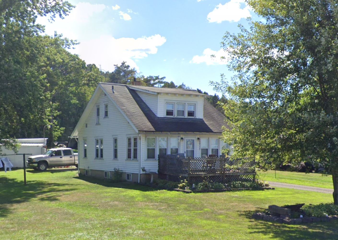
Property Details
Legal Description
Situated in the Village of East Palestine and in the Township of Unity, County of Columbiana, State of Ohio, and being a part of the Southwest Quarter of Section 14, Township 8, Range 1, and being more particularly described as follows; Being a Survey of a parcel conveyed to David Vargo, as recorded in O.R.V. 1208, Page 78, in the Columbiana County Official Records, and being all of Auditor’s P.P.N. 68-04327.000, P.P.N. 67-00384.003, & P.P.N. 67-00384.000, and further described as follows; Commencing at a stone found marking the Northwest Corner of the Southwest Quarter of Section 14, being the Northeast corner of a parcel conveyed to Randel R. Hedger, as recorded in O.R.V. 1256, Page 74, also being the Southwest corner of a 0.302 Acre parcel conveyed to Suleiman Holdings of Ohio, Inc., as recorded in O.R.V. 2220, Page 580, and being the PRINCIPLE PLACE OF BEGINNING of the 7.934 Acre parcel herein to be described; Thence, N 89°07’27” E 621.70 feet with the (East-West) Half Section Line of Section 14, the same being the South line of said parcel conveyed to Suleiman Holdings of Ohio, Inc., extending along a 0.218 Acre parcel conveyed to Suleiman Holdings of Ohio, Inc., as recorded in O.R.V. 2220, Page 580, and extending along the South line of 3 parcels conveyed to Delmar W. & Francis M. Upole, as recorded in D.V. 1403, Page 912, to a mag nail set in the centerline of State Route 14, also being the South line of a parcel conveyed to Harold R. Feezle, as recorded in O.R.V. 1901 Page 102, passing over a 5/8” o.d. iron pin found at 149.66 feet and 552.62 feet respectively; Thence, S 51°30’00” E 192.07 feet with the centerline of State Route 14, the same being the South line of said parcel conveyed to Feezle (ORV1901,Pg.102), to a mag nail set marking the Northeast corner of a 0.325 Acre parcel conveyed to Sarah E. Day, as recorded in O.R.V. 2126, Page 242; Thence leaving State Route 14 with the boundary of said parcel conveyed to Day (ORV2126,Pg242), with the following three (3) courses and distances: 1) S 38°31’22” W 316.40 feet to a ¾” o.d. iron pipe found, and passing over a ¾” o.d. iron pipe found at 35.16 feet; 2) S 84°31’12” E 178.84 feet to a ¾” o.d. iron pipe found; 3) N 38°33’30” E 218.94 feet extending with the South line of a parcel conveyed to Carolyn S. Sheely, as recorded in O.R.V. 1907, Page 948, to a mag nail set in the centerline of State Route 14, also being the South line of said parcel conveyed to Feezle (ORV1901,Pg.102), and passing over a 5/8” o.d. iron pin found at 188.69 feet; Thence, S 51°30’00” E 120.36 feet with the centerline of State Route 14, the same being the South line of said parcel conveyed to Feezle (ORV1901,Pg.102)to a mag nail set marking the Northwest corner of a 0.147 Acre parcel conveyed to Mark J. & Cynthia R. Powers, as recorded in O.R.V. 1425, Page 675; Thence, S 00°16’33” E 158.90 feet leaving State Route 14 with the West line of said parcel conveyed to Powers (ORV1425,Pg675), to a 5/8” o.d. iron pin found on the North line of a 27.416 Acre parcel conveyed to Mark J. & Cynthia R. Powers, as recorded in O.R.V. 349, Page 889, and passing over a 5/8” o.d. iron pin found at 45.10 feet; Thence, S 89°40’31” W 977.69 feet with the North line of said 27.416 Acre parcel conveyed to Powers (ORV349,Pg.889), and extending along the North line of a 31.435 Acre parcel conveyed to Mark J. & Cynthia R. Powers, as recorded in O.R.V. 349, Page 889, and extending along the North line of a parcel conveyed to Jilltin EP Holdings, LLC, as recorded in O.R.V. 2362, Page 265, to a 5/8” o.d. iron pin found on the West line of Section 14, the same being the East line of Section 15, also being the Southeast corner of said parcel conveyed to Hedger (ORV1256,Pg74), and passing over a 5/8” o.d. iron pin found at 745.23 feet;; Thence, N 00°51’39” W 442.89 feet with the East line of said parcel conveyed to Hedger (ORV1256,Pg74) and the East line of Section 15, the same being the West line of Section 14, to the PRINCIPLE PLACE OF BEGINNING, and containing 7.934 Acres, more or less, (0.238 Acres within the Right of Way of State Route 14 and Township of Unity), and is subject to all legal easements, right of ways, zoning restrictions, and ordinances of record. The acreage in the above described 7.934 Acre parcel is broken down as follows: 0.146 Acres in P.P.N. 67-00384.003 (Township of Unity) 0.092 Acres in P.P.N. 67-00384.000 (Township of Unity) 7.696 Acres in P.P.N. 68-04327.000 (Village of East Palestine) 7.934 Acres TOTAL The bearings of the above description are based on the centerline of State Route 14, as being S 51?30'00" E, as recorded in O.R.V. 1208, page 378, in the Columbiana County Official Records, and is an assumed Meridian used to denote angles only. All iron pins set are 5/8” o.d. reinforcing bars 30” long with red caps labeled “S.A. ENGLAND #7452”. The above description was prepared by S.A. England Surveying, under the direct supervision of Scott A. England, Ohio Registered Surveyor #S-7452 in June of 2020.
Location
Foreclosure Details
Click the link to review the Conditions of Sale for this auction.
Conditions of SaleAuction By
