Property Details
Property Description
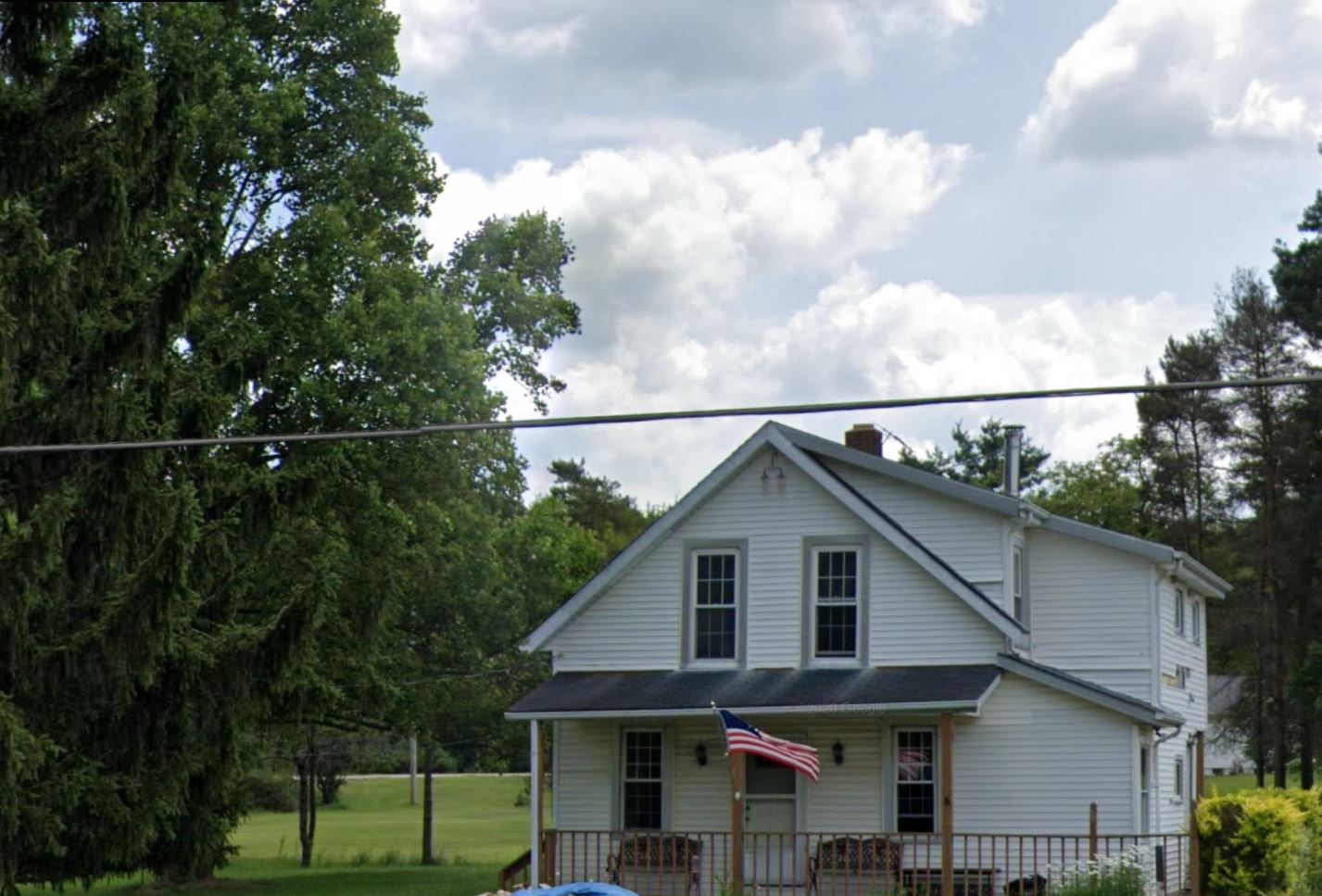
Subject property is a 3 BR / 2.00 BA Single Family Home w/ 1 Car Garage, containing 1,360 Sq Ft +/- built in 1960. Parcel number: 20-070620, 20-070630. Minimum Bid $ 63,333.33 . All auction end Wednesdays at 1PM. 5% buyer's premium will apply over and above high bid. Please read terms and conditions for details related to purchasing foreclosure property. Interior showings are not available. To earn a commission, Buyer referrals must be made to Auctioneer before prospective buyers make any contact with Auctioneer or register for bidding. Use link: https://www.gryphonusa.com/broker-acknowledgement-form/ This is a foreclosure situation. Property being offered by Private Selling Officer per the authorities granted in Ohio Revised Code 2329.152 . Information available has come from public sources and is believed to be accurate but is not guaranteed. Buyers should conduct their own due diligence before bidding. List Agent has not physically viewed the property. Due to the nature of the sale, interior inspections are not allowed. Cash sale only. The auction is subject to postponement and cancellation. No financing.
Legal Description
Parcel No. 1: Situated in the Township of Montville, County of Geauga and State of Ohio: known as being part of Lot 5, Section 18 in the said Township and is bounded and described as follows: Beginning in the centerline of Madison-Middlefield Road at a point which is located South 07°08'30" West, a distance of 304.97 feet from the intersection of said centerline with the centerline of Plank Road. Thence from said place of beginning South 84°40'30" East, a distance of 168.03 feet to the Northwest corner of land of Edward J. and Marie M. Hajjar, as recorded in Vol. 259, Page 1 of Geauga County Deed Records: Thence along the West line of land of the said Hajjar, South 07°08'30" West, a distance of 176.20 feet; Thence by a line which bears North 87°06'30" West, a distance of 168.40 feet to the centerline of Madison-Middlefield Road; Thence along said centerline, North 07°08'30" East, a distance of 183.50 feet to the place of beginning and containing 0.695 acres of land as calculated and described by R.C. Dillworth, Reg. Surveyor No. 4215, Crabbs Surveying Service. Parcel No. 2: Situated in the Township of Montville, County of Geauga and State of Ohio: Known as being a part of Lot 5, Section 18, in said Township and is bounded and described as follows: Beginning in the centerline of Middlefield-Madison Road at the Southwest corner of land of Louis W. Burger, as recorded in Volume 257, Page 654 of Geauga County Deed Records; Thence along the South line of land of the said Burger and land of Edward J. and Marie M. Hajjar, as recorded in Vol. 259, Page 1 of the Geauga County Deed Records, South 87°08'30", East a Distance of 589.49 feet to the centerline of the Painesville-Warren Road; Thence along said centerline, South 45° and 46" East, a distance of 104.40 feet; Thence by a line which bears North 87°08'30" West, a distance of 673.0 feet to the centerline of Middlefield-Madison Road; Thence along said centerline, North 7°08'30" East, a distance of 69.20 feet to the place of beginning and containing 1.000 acres of land as calculated and described by R. C. Dillworth, Reg. Surveyor No. 4215, be the same more or less, but subject to all legal highways. Excepting from the above description, the following described property: Situated in the Township of Montville, County of Geauga and State of Ohio: Known as being a part of Lot 5, Section 18 in said Township and is bounded and described as follows; Beginning in the centerline of Painesville-Warren Road at the Southeasterly corner of land of Edward J. and Marie M. Hajjar, as recorded in Vol. 259, Page 1 of Geauga County Deed Records; Thence along the South line of land of said Hajjar, North 87°08'30" West, a distance of 354.09 feet; Thence by a line which bears South 02°51'30" West a distance of 69.01 feet; Thence by a line which bears South 87°08'30" East, a distance of 432.43 feet to the centerline of Painesville-Warren Road; Thence along said centerline, North 45° and 46' West, a distance of 104.40 feet to the place of beginning and containing 0.623 acres of land as calculated and described by R.C. Dillworth, Reg. Surveyor No. 4215, Crabbs Surveying Service. Be the same more or less, but subject to all legal highways.
Location
Foreclosure Details
Click the link to review the Conditions of Sale for this auction.
Conditions of SaleAuction By
