Property Details
Property Description
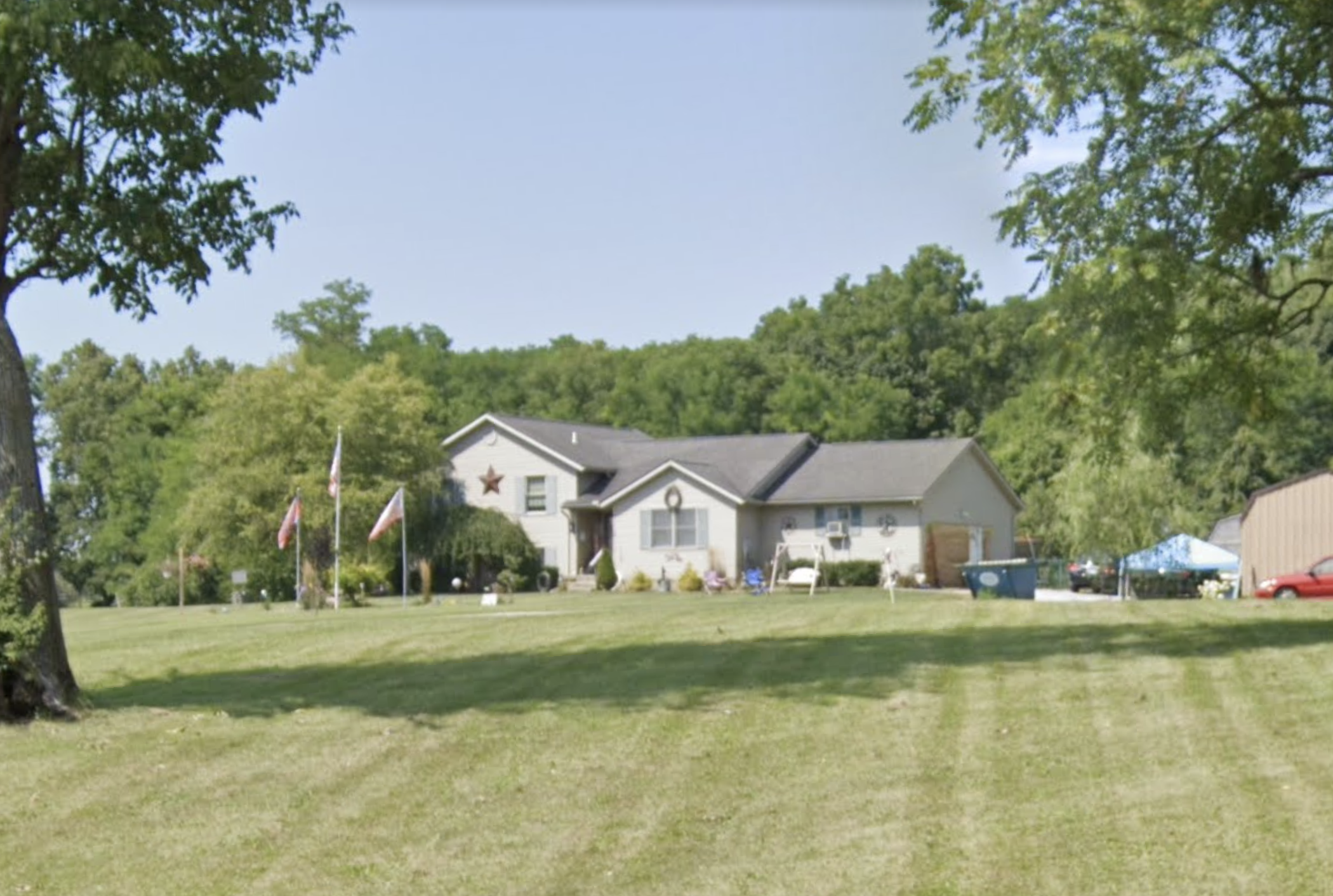
Subject property is a 4 BR / 2.00 BA Single Family Home w/ 1 Car Garage, containing 1,490 Sq Ft +/- built in 2003. Parcel number: 3000600023100048. Minimum Bid $ 250,000.00 . All auction end Wednesdays at 1PM. 5% buyer's premium will apply over and above high bid. Please read terms and conditions for details related to purchasing foreclosure property. Interior showings are not available. To earn a commission, Buyer referrals must be made to Auctioneer before prospective buyers make any contact with Auctioneer or register for bidding. Use link: https://www.gryphonusa.com/broker-acknowledgement-form/ This is a foreclosure situation. Property being offered by Private Selling Officer per the authorities granted in Ohio Revised Code 2329.152 . Information available has come from public sources and is believed to be accurate but is not guaranteed. Buyers should conduct their own due diligence before bidding. List Agent has not physically viewed the property. Due to the nature of the sale, interior inspections are not allowed. Cash sale only. The auction is subject to postponement and cancellation. No financing.
Legal Description
Tract I: Situated in the Township of Springfield, County of Clark and State of Ohio, and bounded and described as follows: Being and lying within the bounds of the Northwest Quarter of Section Numbered Twenty Three (23), Town Four (4), Range Nine (9) in the between the Miamis Survey. From the point which identifies the Southeast corner of the Quarter Section, measure along the half section line, North 04 deg. 14' East, 1036.54 feet to a point falling in the centerline of the Sintz Road; thence with the roadway, but not necessarily in its centerline, North 89 deg. 41' West, 201.30 feet to the place which establishes the beginning point of this description and the extreme Southeast corner of the parcel of land to be described. Thence from the point of beginning and continuing with the Sintz Road, North 89 deg. 40' West, 160.00 feet to a point; Thence leaving the roadway, North 00 deg. 19' East, at 30.00 feet passing an iron pin, in all 320.40 feet to an iron pin; thence South 89 deg. 41' East, 170.73 feet to an iron pin; thence South 12 deg. 21' 10" West, 166.23 feet to an iron pin; thence South 08 deg. 18' 30" East, 129.29 feet passing an iron pin, in all 159.63 feet to the place of beginning, containing an area of one and one hundred nine thousandths (1.109) acres, more or less, of this amount, 0.109 of an acre is occupied by the right of way for the public road. Subject to an easement heretofore granted to the Standard Oil Company for a pipeline right of way, as evidenced by the conveyance receded in Deed Book 317, Page 561 of the Deed Records of Clark County, Ohio. This conveyance is subject to a restriction required by the County Engineer limiting a driveway on said premises for ingress and egress to be limited to fifty (50) feet of the West property line of said premises. Reserving along the entire frontage of the above described premises, a perpetual easement and right of way to permit future improvement to the public road. The easement strip measures thirty (30) feet in even width and shall not hinder in any way access to the property. The easement is required in order to satisfy local subdivision regulations. The boundary line description for the above division of land was prepared in July 1989 by Carl F. Swartzbaugh, a Registered Land Surveyor with an Ohio Certificate Number of S-02644, in agreement with the survey filed in Volume 7, Page 1746 of the Clark County Engineer's Revised Record of Land Survey. Tract II Situate in Section 23, Town 4, Range 9, Township of Springfield, County of Clark and State of Ohio, and being part of a 13.95 acre tract conveyed to Oran R. Sine, Jr. in Official Record 1477, Page 1243 and Official Record 1479, Page 1914, more particularly described as follows: Beginning at a mag nail set at the intersection of the centerline of Sintz Road and the East line of the Northwest Quarter of Section 23, thence along the centerline of Sintz Road, North 89 deg. 41' 00" West a distance of 140.61 feet to a mag nail set at the Southwest corner of a 0.733 acre tract conveyed to John Robert Fleming and Cheryl L. Fatzinger in Deed Volume 737, Page 154, said point being the true place of beginning. Thence continuing along the centerline of Sintz Road, North 89 deg. 41' 00" West a distance of 60.69 feet to a mag nail set at the Southeast corner of a 1.109 acre tract conveyed to Oran R. Sine, Jr. in Official Record 1471, Page 2658 and Official Record 1479, Page 1914; Thence along the East line of said 1.109 acre tract, North 08 deg. 17' 05" West, passing a 5/8" iron pin found on the North right-of-way line of Sintz Road at 30.34 feet, a total distance or 159.63 feet to a 5/8" iron pin found; Thence continuing along the East line of said 1.109 acre tract, North 12 deg. 22' 11" East a distance of 166.23 feet to a 5/8" iron pin found at the Northeast comer of said 1.109 acre tract; Thence along the North line of said 1.109 acre tract, North 89 deg. 41' 00" West a distance of 170.45 feet to a 5/8” iron pin set at the Northwest corner of said 1.109 acre tract and the Southeast corner of a 0.551 acre tract conveyed to William S. and Cathy C. Manker in Official Record 1415, Page 1129; Thence along the East line of said 0.551 acre tract, North 00 deg. 19' 00" East a distance of 159.86 feet to a 5/8" iron pin with RET cap found at the Northeast corner of said 0.551 acre tract; Thence along a new division line, South 89 deg. 36’ 51" East a distance of 363.27 feet to a 5/8" iron pin set on the West line of a 0.35 acre tract conveyed to Clyde Schmedeke in Deed Volume 712, Page 712; Thence along the West line of said 0.35 acre tract South 05 deg. 24’ 04” East a distance of 155.55 feet to a 5/8" iron pin set at the Northeast comer of a 0.516 acre tract conveyed to Tim M. Matthews in Official Record 1396, Page 1163; Thence along the North line of said 0.516 acre tract, South 84 deg. 35' 56" West a distance of 150.00 feet to a 1/2” iron pipe found at the Northwest corner of said 0.516 acre tract; Thence along the West line of said 0.516 acre tract, South 05 deg. 24' 04" East a distance of 150.00 feet to a 1" iron pipe found at the Southwest corner of said 0.516 acre tract and on the North line of said 0.733 acre tract; Thence along the North line of said 0.733 acre tract, South 84 deg. 35' 56" West a distance of 48.00 feet to a 1" iron pipe found at the Northwest corner of said 0.733 acre tract; Thence along the West line of said 0.733 acre tract, South 08 deg. 17' 05" East, passing a 5/8" iron pin set on the North right-of-way line of Sintz Road at 127.50 feet and passing a 1" iron pipe found at 137.70 feet, a total distance of 157.85 feet to the true place of beginning. Containing 1.901 acres, more or less, of which 0.042 acres are within the right-of-way of Sintz Road, leaving a net area of 1.859 acres. Subject to all legal highways, easements and restrictions of record. The above described tract does not create a new building parcel and is to be attached to the 1.109 acre tract conveyed to Oran R. Sine, Jr. in Official Record 1471, Page 2658 and Official Records 1479, Page 2658. Basis of Bearings: Centerline of Sintz Road - Sur. Vol. 13, Page 46, North 89 deg. 41' West. A (5/8" iron pin set) refers to a 30" long rebar with a plastic identification cap stamped "Haley-Dusa 6819." This description is based upon a survey conducted under the supervision of John P. Haley, Registered Surveyor, Ohio License Number 6819, in July of 2001.
Location
Foreclosure Details
Click the link to review the Conditions of Sale for this auction.
Conditions of SaleAuction By
