Property Details
Property Description
Subject property is a 3 BR / 2.00 BA Single Family Home w/ No Garage, containing 1,188 Sq Ft +/- built in 2015. Parcel number: 261609039000. Minimum Bid $ 60,000.00 . All auction end Wednesdays at 1PM. 5% buyer's premium will apply over and above high bid. Please read terms and conditions for details related to purchasing foreclosure property. Interior showings are not available. To earn a commission, Buyer referrals must be made to Auctioneer before prospective buyers make any contact with Auctioneer or register for bidding. Use link: https://www.gryphonusa.com/broker-acknowledgement-form/ This is a foreclosure situation. Property being offered by Private Selling Officer per the authorities granted in Ohio Revised Code 2329.152 . Information available has come from public sources and is believed to be accurate but is not guaranteed. Buyers should conduct their own due diligence before bidding. List Agent has not physically viewed the property. Due to the nature of the sale, interior inspections are not allowed. Cash sale only. The auction is subject to postponement and cancellation. No financing.
Legal Description
Situated in the County of Ross in the State of Ohio and in the Township of Scioto and Bounded and described as follows: First Tract: Beginning at a stone in the North West corner of the tract herein described, and corner to Tract No. 2, herein described; thence with the line of the second tract herein described N. 29 deg. E. 10.7 chains to a stone in said line and corner to William P. Mathias' land; thence with his line S. 54 deg. 10' E. 8 chains to a post in said Line; thence with a new line S. 44 deg 54' W. 11.63 chains to a post in the line of the second tract herein described; thence with said line N. 44 deg. 27' W. 5 chains to the place of beginning, containing 7.165 acres or land, more or less, being a part of Virginia Military Survey No. 529 and being the same premises Conveyed to Alonzo T. Swepston by Nemuel Leffler by Deed dated November 27th, 1915, and recorded in Vol. 175, Page 397, Ross County, Deed Records. Second Tract: Beginning at the South-West corner of the tract herein described, and at a stone in the line of the land of Philip Mack (formerly William Allen Leffler) and being the North West corner of tract one herein described, thence with a line of said Mack's land N. 45 deg 8' W. 19.76 chains to a stone in the line of the land belonging to the heirs of John Kern, deceased; thence with their line, N. 44 deg. 46' E. 12.33 chains to a stone; thence N. 40 deg. 50' W. 30.20 chains to a stone pile in the original line of said Survey; thence S. 78 deg. E. 1.75 chains to the center of the Pike; thence down the pike, S. 53 deg. 30' E 3.89 chains; thence S. 62 deg. 30' E. 12.82 chains; thence S. 54 deg. 30' E. 6.46 chains; thence S. 76 deg. E. 6 Chains; thence S. 65 deg. E. 2 chains to the South-West corner of Edgington's tract of 14.6 acres; thence with his line to the center of the pike, S. 73 deg. 35' E. 5.4 chains; thence leaving the pike S. 29 deg. E. 14.47 chains to a stone, corner to Nemuel Leffler's tract; thence with his line S. 44 deg. 27' E. 10 chains to a stone; thence S. 44 deg. 54' W. 13 chains to the place of beginning, containing 50 acres of land, more or less. Excepting therefrom the following described tract: Beginning at a stone and stone pile in the original line of Survey No. 529, the Northwest corner of the tract herein described; thence S. 78 deg. E. 1.75 chains to the center of the pike; thence down the pike S. 53 deg. 30' E. 12.6 chains to a point in the pike; thence leaving the pike with a new line S. 47 deg. 45' W. 6.5 chains to a point in the line of John Kern, deceased, land; thence with his line N. 40 deg. 50' W. 17.1 chains to the place of beginning, containing 5.58 acres of land, more or less. Also Save and except the following tracts: 1st Tract: 1.489 acres, more or less, conveyed to Bertha Harrington by J.Z. Vandermark by Warranty Deed dated 7 February 1942 and recorded in Volume 238, Page 117 of the Ross County, Ohio, Deed Records, to which reference is hereby made for a more complete description. 2nd Tract: 1 Acre, more or less, conveyed to Earl Deeter By J.Z. Vandermark by Warranty Deed dated 10 July 1943 and recorded in Volume 241, Page 45 of the Ross County, Ohio Deed Records, to which reference is hereby made for a more completed description. 3rd Tract: 5.33 Acres, more or less, conveyed to Andrew A. Rusenko by Joseph Z. Vandermark by Warranty Deed dated 24 April 1944 and recorded in Volume 242, Page 567 of the Ross County, Ohio Deed Records, to which Reference is hereby made for a more complete description. Save and Except 1.26 Acres Set Forth herein as Parcel One.
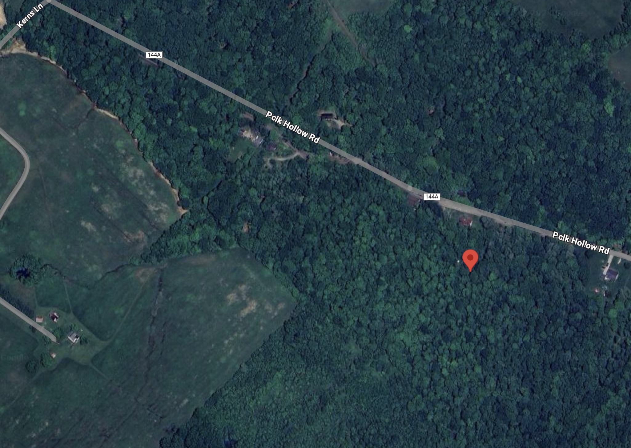
Location
Foreclosure Details
Conditions of Sale
Auction By
