Property Details
Property Description
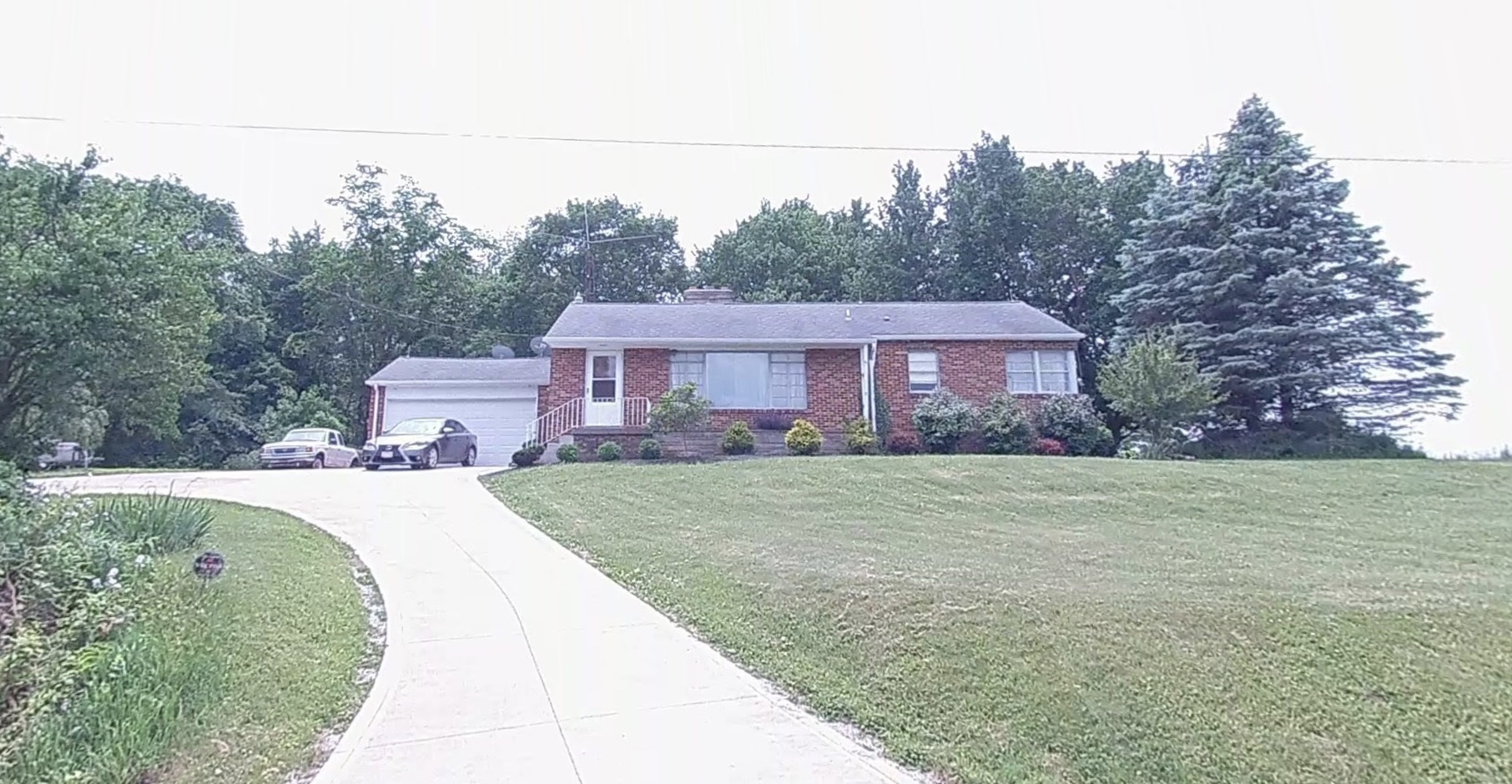
Subject property is a 3 BR / 1.50 BA Single Family Home w/ 1 Car Garage, containing 1,242 Sq Ft +/- built in 1958. Parcel number: 0181413612000. Minimum Bid $ . All auction end Wednesdays at 1PM. 5% buyer's premium will apply over and above high bid. Please read terms and conditions for details related to purchasing foreclosure property. Interior showings are not available. To earn a commission, Buyer referrals must be made to Auctioneer before prospective buyers make any contact with Auctioneer or register for bidding. Use link: https://www.gryphonusa.com/broker-acknowledgement-form/ This is a foreclosure situation. Property being offered by Private Selling Officer per the authorities granted in Ohio Revised Code 2329.152 . Information available has come from public sources and is believed to be accurate but is not guaranteed. Buyers should conduct their own due diligence before bidding. List Agent has not physically viewed the property. Due to the nature of the sale, interior inspections are not allowed. Cash sale only. The auction is subject to postponement and cancellation. No financing.
Legal Description
Situated in the Township of Monroe, County of Richland, State of Ohio and being a part of the Northwest Quarter of Section 23, Township 22, Range 17 and being more Particularly described as follows: Commencing at an iron pin found in the Southeast corner of said Northwest Quarter; Thence S 90 degrees 00' 00" W. 359.77 feet along the South line of said Northwest Quarter to a railroad Spike found in the centerline of Lucas Perrysville road (C.H. 96); Thence N 17 degrees 58' 00" W., 139.69 feet along said centerline to a railroad Spike Set in a Point of Curve; Thence continuing along said centerline Northwesterly on a curve to the left having A radius of 485.00 feet, an arc length of 175.20 feet and a chord length of 174.25 feet Bearing N 28 degrees 18' 55" W to a railroad spike set, said railroad spike being in the Northeasterly corner of a parcel of land conveyed to Paul, Jr. And Leile Ernsberger By Volume 58, Page 786 of Richland County Official records, and being the true Place Of Beginning; Thence S 39 degrees 50' 17" W. 200.00 feet to an iron pin set in the Southeasterly corner of said land of Paul, Jr. and Leile Ernsberger and passing through an iron pin set at 30.66 feet; Thence N 49 degrees 39' 25" W, 200.00 feet to an iron pin set in the Southwesterly corner Of said land of Paul, Jr. and Leile Ernsberger; Thence N. 39 degrees 50' 17" E, 200.00 feet to a railroad spike set in the Northwesterly Corner of aid land of Paul, Jr. and Leile Ernsberger, also being in said centerline of C.H. 96 and passing through an iron pin found at 178.69 feet; Thence S 55 degrees 55' 59" E., 54.82 feet along said centerline to a railroad spike set in A point of curve; Thence Southeasterly along said centerline on a curve to the right having a radius of 485.00 feet, an arc length of 146.18 feet and a chord length of 145.63 feet bearing S 47 degrees 17' 54" E to the true place of beginning and containing 0.944 acres, more or Less, but subject to all legal Highways and easements of record. Bearings are to an assumed meridian and are used to express angles only. All iron pins set are 5/8" diameter rod with plastic cap stamped "S.J.L. Inc. According to a Survey made in July 1992 by Roger L. Stevens, Ohio registered Surveyor No. 7052.
Location
Foreclosure Details
Click the link to review the Conditions of Sale for this auction.
Conditions of SaleAuction By
