Property Details
Property Description
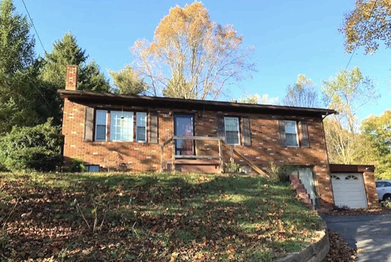
Subject property is a 3 BR / 2.00 BA Single Family Home w/ 1 Car Garage, containing 1,107 Sq Ft +/- built in 1949. Parcel number: 17-001-0400.000. Minimum Bid $ 43,333.33 . All auction end Wednesdays at 1PM. 5% buyer's premium will apply over and above high bid. Please read terms and conditions for details related to purchasing foreclosure property. Interior showings are not available. To earn a commission, Buyer referrals must be made to Auctioneer before prospective buyers make any contact with Auctioneer or register for bidding. Use link: https://www.gryphonusa.com/broker-acknowledgement-form/ This is a foreclosure situation. Property being offered by Private Selling Officer per the authorities granted in Ohio Revised Code 2329.152 . Information available has come from public sources and is believed to be accurate but is not guaranteed. Buyers should conduct their own due diligence before bidding. List Agent has not physically viewed the property. Due to the nature of the sale, interior inspections are not allowed. Cash sale only. The auction is subject to postponement and cancellation. No financing.
Legal Description
DESCRIPTION for 1.421 ACRES A certain tract of land situate in the State of Ohio, Lawrence County, Perry Township Section 32 Township 1 North, Range 18 West, of the Congress Lands East of the Scioto River, and being more particularly bounded and described as follows: BEGINNING at a point in the centerline of State Route 243, commonly known as Marion Pike, marking a corner common to the lands now for formerly owned by Zoar Missionary Baptist Church, Inc., (O.R.V. 1057, Pg. 390), and the lands now owned by Edna L. Robbins, (O.R.V. 1076, Pg. 658), having a coordinate value of N. 181,835.23 and E. 1,931,773.76, from which a stone marked with a “+” (found), marking the southwest corner of Section 32, Township 1 North, Range 18 West, located on the east corporation line of the Village of Coal Grove, and on the line between Upper and Perry Townships, and on the line between Sections 31 and 32, bears: South 10o21’19” West 1,325.36 feet; thence, leaving the centerline of the said State Route 243, and with the lands of the said Zoar Missionary Baptist Church, as follows: North 11°09'55" East, passing a 1” iron pin (found), at 46.41 feet, in all 196.74 feet to a 1” iron pipe (found), North 41°16'34" East 142.84 feet to a ?” reinforcing rod with a red plastic cap (found), South 50°54'03" East 222.55 feet to a 1” iron pipe (found), South 34°22'55" East 54.66 feet to a point in the centerline of the said State Route 243; thence, leaving the lands of the said Zoar Missionary Baptist Church, and with the centerline of the said State Route 243, with a curve to the right having a radius of 385.00 feet, and an arc length of 346.88 feet, the long chord of which bears: South 69°35'02" West 335.26 feet; thence, continuing with the centerline of the said State Route 243, North 84°36'18" West 21.80 feet to the POINT OF BEGINNING, containing 1.421 acres, more or less, as surveyed under the supervision of Jeffrey M. Eastham, Ohio Registered Professional Surveyor No. 7695, on November 11, 202, as shown on the attached plat for Job No. 20231108 OL and made a part of this description. This survey is based on the Ohio State Coordinate System, South Zone, NAD '83, U.S. Survey feet. L.S.O.T.: Official Record Volume 1076, Page 658, recorded in the Office of the Recorder of Lawrence County, Ohio. It is the intent to combine the Auditor's Tax Parcel Number 17-001-0200.000 into the Auditor's Tax Parcel Number 17-001-0400.000 with a new acreage of 1.421 Ac. This survey does not constitute a Title Search by the Surveyor. No Title Commitment was provided. This survey is subject to all restrictions, reservations, right-of-ways, easements, utilities, covenants, exceptions, conveyances, leases and exclusions previously imposed and appearing of record, and those not of record, especially the existing 15 foot right-of-way from the subject property to the said State Route 243 for ingress-egress. JEFFREY M. EASTHAM REGISTERED SURVEYOR NO. 7695
Location
Foreclosure Details
Click the link to review the Conditions of Sale for this auction.
Conditions of SaleAuction By
