Property Details
Property Description
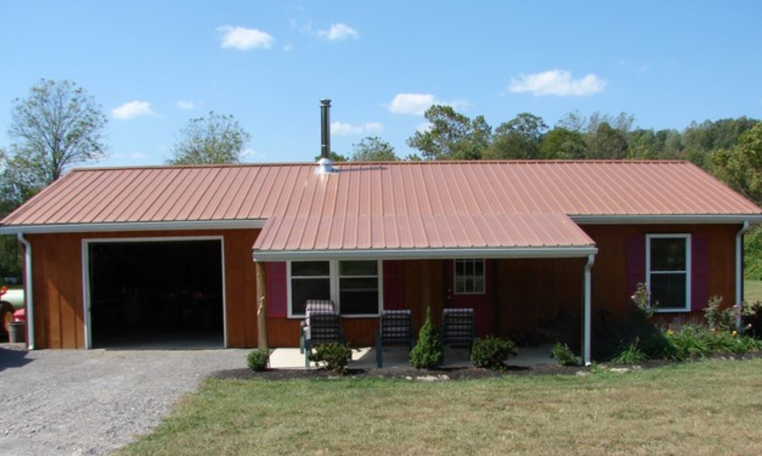
Subject Property is a 2 BR / 1 BA Single Family Home w/ containing 720 Sq Ft +/- built in 2009. Minimum bid $ 40,000.00. All auctions end Wednesday's at 1pm. 5% buyers premium will apply over and above high bid. Please read terms and conditions for details related to purchasing foreclosure property. Interior showings are not available. Buyer agents must register with Auctioneer to earn commission at https://www.gryphonusa.com/broker-acknowledgement-form/ *** Information available has come from public sources and is believed to be accurate but is not guaranteed. Buyers should conduct their own due diligence before bidding. Auctioneer/PSO has not physically viewed the property.
Legal Description
Situate in the Township of Bloom, County of Scioto, State of Ohio and being a part of the S/W 1/4 of the N/E 1/4 of Section 2, Township 4 North, Range 19 West being also a part of David Swick's Tract 4 (DD) Parcel 01-0372.003 Official Records Vol. 34 Pg. 180 and being more particularly described as follows: Commencing at an existing P.K. nail in the centerline of Dutch Hollow Rd. in the center of a bridge at the N/E corner of the S/W 1/4 of the N/E 1/4 of Section 2, Township 4N, Range 19W, said P/K also being the Grantor's northeast corner and the southeast corner of John & Linda Picklesimer's tract as recorded in D.B. Vol. 832 Pg. 174, thence with said road and the east line of the Grantor S 01 degree 53' 18" W, 20.00' to the true Point of Beginning of this conveyance, thence continuing with said road S 01 degree 53' 18" W, a distance of 442.79' to an iron pin (Found) said iron pin being in the west line of William Arthur & Flo Madden's tract as recorded in D.B. Vol. 960 Pg. 3 & 4; thence N 67 degrees 51' 09" W, a distance of 15.00' to a point in the centerline of said Dutch Hollow Rd., to the point of curvature of a non-tangent curve, concave to the northwest, having a radius of 135.94' a central angle of 20 degrees 14' 00", and a chord of 47.76' bearing S 32 degrees 15' 55" W; thence South along said curve, a distance of 48.01'; thence leaving said road and with a new division line through the Grantor by two courses as follows N 42 degrees 44' 00" W, passing through a 5/8" x 30" rebar (Set) at 23.76' a total distance of 347.89' to a 5/8" x 30" rebar (Set) and N 52 degrees 36' 07" E, 365.10' to the beginning and containing 1.6393 acres. Bearing are based on a survey of the Grantors tract by T.G. Smith Dated 10-2005. Being subject to all legal highways and easements of Record. The above description is based on an actual survey by Hubert M. Crabtree P.S. #6810 Dated 12-23-08.
Location
Foreclosure Details
Click the link to review the Conditions of Sale for this auction.
Conditions of SaleAuction By
