Property Details
Property Description
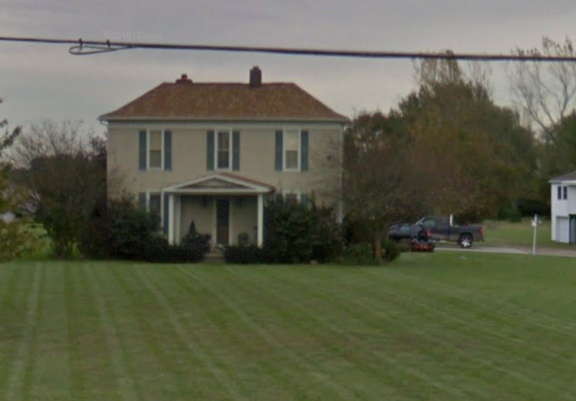
Subject Property is a 4 BR / 2 BA Single Family Home containing 3319 Sq Ft +/- built in 1900. Parcel number 190-008-0-05-008-00. Minimum bid $ 100,000. All auctions end Wednesday's at 1pm. 5% buyers premium will apply over and above high bid. Please read terms and conditions for details related to purchasing foreclosure property. Interior showings are not available. Buyer agents must register with Auctioneer to earn commission at https://www.gryphonusa.com/broker-acknowledgement-form/ *** Information available has come from public sources and is believed to be accurate but is not guaranteed. Photos are for marketing purposes only. Buyers should conduct their own due diligence before bidding. Auctioneer/PSO has not physically viewed the property.
Legal Description
Situated in the Township of Union, County of Fayette and State of Ohio: V.M.S. 4483 and being part of a 3.949 acre tract conveyed to Lloyd H. Cartwright, by deed book 166 page 725 and being more particularly described as follows: Beginning at a point in the Centerline of U.S. Route 62 and State Route 3 said point being the southwest corner of a 1.98 acre tract and the west corner of 0.071 acre tract both conveyed to William A. and Ida M. Newland by deed book 164, page 341; thence, with the south line of said 0.071 acre tract south 71 deg. 34 min. 10 sec. East passing a 3/4 inch inside diameter iron pipe found at 40.31 feet and also passing a 1/2 inch diameter solid iron pin found at 599.79 feet a total distance of 600.39 feet to a point in the west line of 39.30 acre tract conveyed to Lorna Jo Grim by deed book 149 page 143; thence, with the west line if said 39.30 acre tract south 12 deg 5 min. 21 sec. west a distance of 144.40 feet to an iron pin and cap set; thence, with a new line across said 3.949 acre tract north 71 deg. 34 min. 10 sec. west passing an iron pin and cap set at 619.66 feet a total distance if 660.41 feet to a point in the Centerline of U.S. route 62 and state route 3; thence with the centerline of U.S. 62 and State Route 3 north 35 deg. 30 min. 00 sec. east a distance of 150.13 feet to the point of beginning containing 2.0770 acres more or less. Bearings are based on the Centerline of U.S. Route 62 and State Route 3 (north 35 deg. 30 min. east) as described in deed book 166, page 725 all as shown on the plat attached and made a part hereof. This deed is subject to and with the benefit of all legal highways. restrictions, easements, limitations, and reservations of record, if any and to zoning restrictions which have been imposed thereon, if any. all iron pins set are 5/8 inch diameter Rebar with yellow plastic caps stamped "Cottrill #6858".this description is based on a field survey performed Sept. 17, 1991, by James R. Cottrill registration #6858. the here-in-above described 2.0770 acres is with the benefit of the following described 25 foot ingress and egress easement; Said 25 foot ingress and egress easement is partially along the southwest line of the here-in-above described 2.0770 acre tract and begins at the southeast right-of-way of U.S. route 62 and state route 3 and extends southeast and is tangent to and 25 feet right of the following described baseline; beginning at iron pin and cap set in the southeast right-of-way of U.S. route 62 and state route 3 said point is in the southwest line of the here-in-above described 2.0770 acre tract; Thence south 71 deg. 34 min. 10 sec. west a distance of 215.00 feet to a point in the southwest line of said 2.0770 acre tract.
Location
Foreclosure Details
Click the link to review the Conditions of Sale for this auction.
Conditions of SaleAuction By
